
The Lopdell Estate, Church Rd / Trench Rd, Londonderry, BT47 3QQ
Development Opportunity
POA
Property Overview
Status
For Sale
Land Type
Development Opportunity
Property Features
Size
42.61 acres

Marketed by Alexander Gourley Ltd (Derry / Londonderry & Donegal)
+44 28 7134 6612
Additional Information
FOR SALE
LAND WITH DEVELOPMENT POTENTIAL
CHURCH RD / TRENCH RD, LONDONDERRY
APPROX 42.61 ACRES
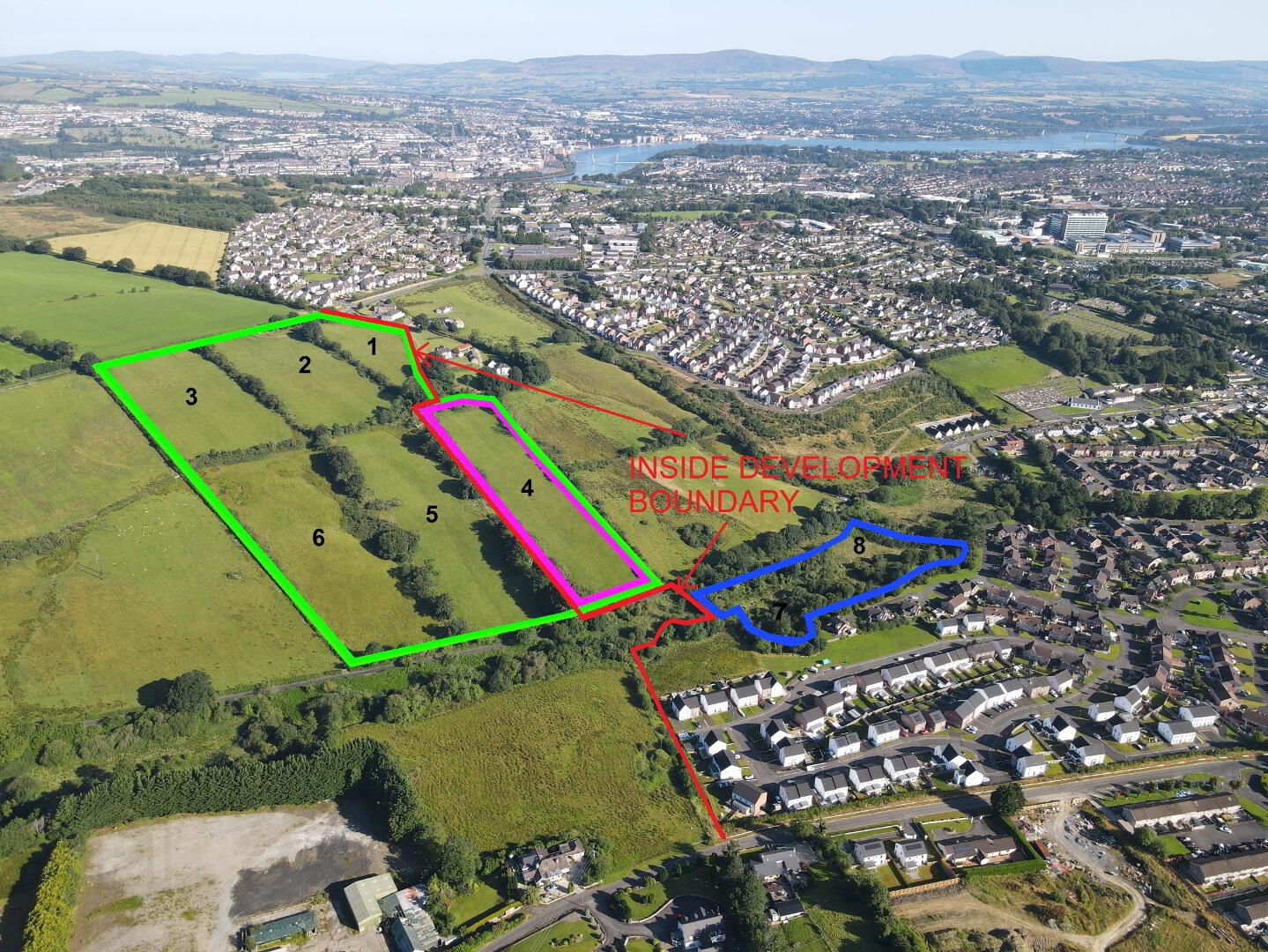
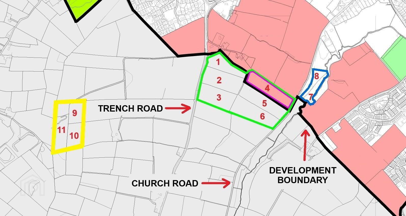
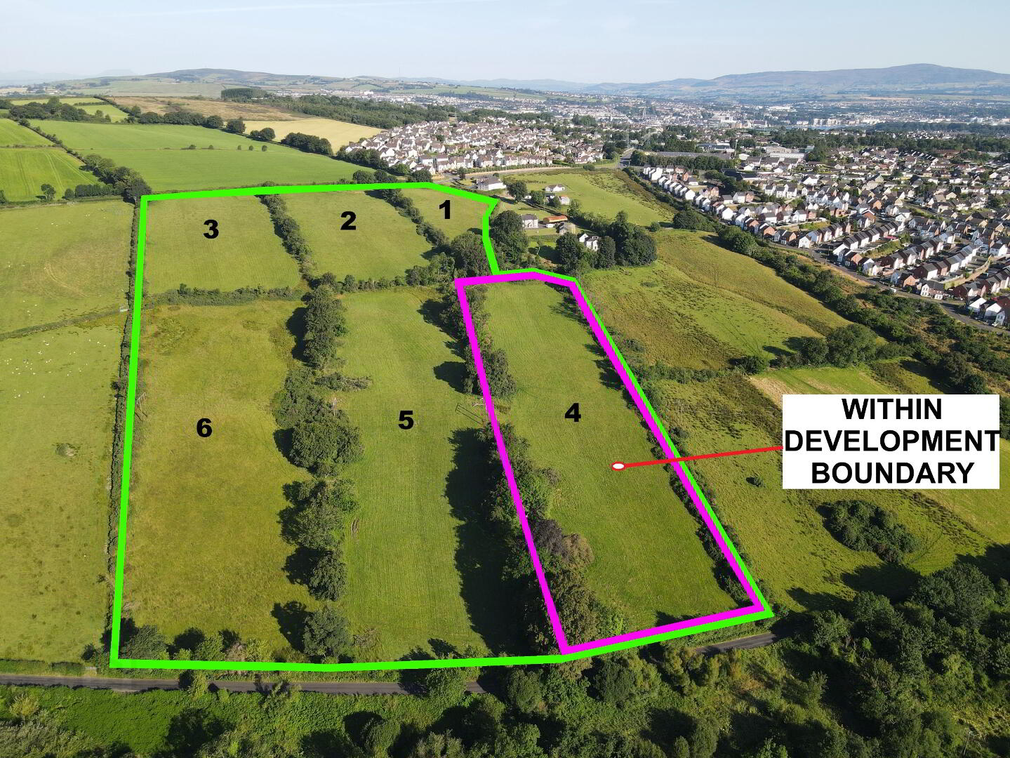
‘THE LOPDELL ESTATE’ - APPROX 42.61 ACRES OF LAND WHICH INCLUDES 5.35 ACRES OF LAND ALREADY ZONED FOR DEVELOPMENT, 3.25 ACRES WITHIN THE DEVELOPMENT BOUNDARY AND A FURTHER 25.02 ACRES BENEFITTING FROM A DEVELOPMENT APPLICATION SUBMITTED INTO THE CURRENT AREA PLAN CALL. SITUATED IN A PRIME LOCATION, NESTLED BEWTEEN THE TRENCH AND CHURCH ROADS, CLOSE TO THE CITY AND THE A6 ARTERIAL ROUTE
| Field Attributes |
| Field No | Acres |
1 2 3 4 5 6 7 8 9 10 11 | 3.34 5.18 4.90 5.35 5.14 5.46 1.99 1.26 2.27 2.79 4.93 |
| Total | 42.61 |
LOT 1
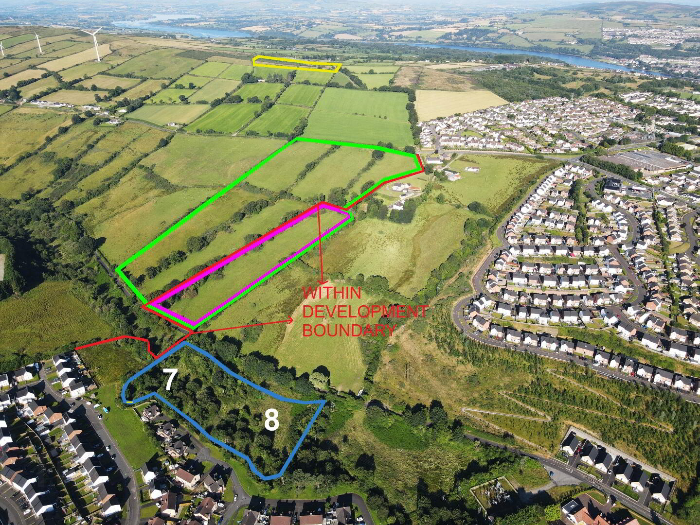
This parcel of land consists of 29.37 acres. There is approx. 24.02 acres of agricultural elevated, slightly inclined, south facing upland grazing, close to the local electrical sub station. Field 4 contains 5.35 acres which is zoned within the town development boundary. The land has good road frontage off the Church Road and Trench Road.
These lands are being sold with a number of ground rents. Details provided on request.
LOT 2
This small parcel of approx. 3.25 acres, contained in Fields 7 and 8, sits adjacent to the popular and extensive residential development of Ivy Mead and may have future development potential, as inside the development boundary.
LOT 3
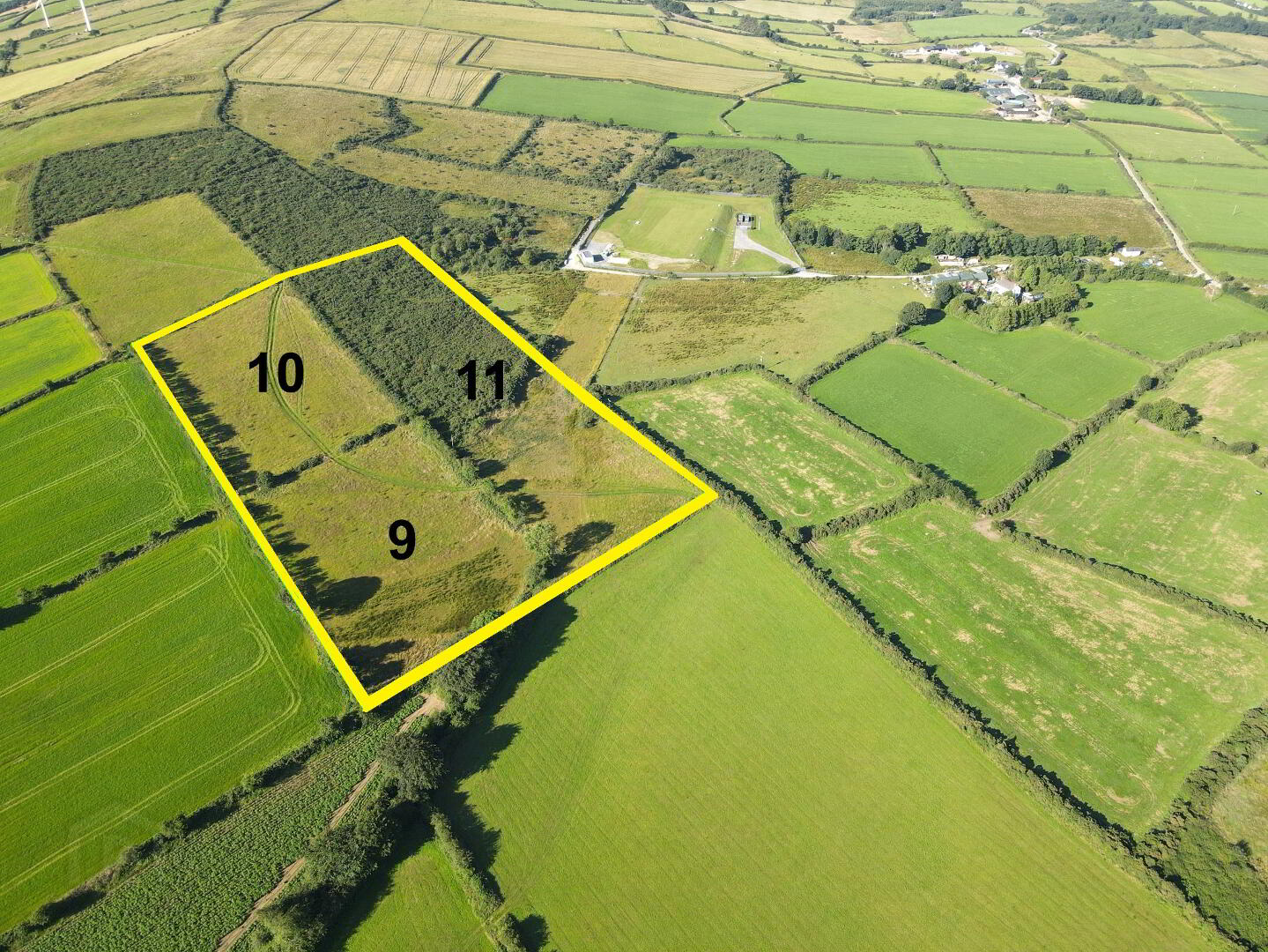
There are approx. 9.99 acres of agricultural grazing land which is accessed via a shared laneway off the Trench Road. Field 9,10 and 11 are elevated upland.
Directions – Church Road
From the Altnagelvin Roundabout – exit the roundabout onto the A6 Glenshane Road towards Drumahoe, passing the entrance to Altnagelvin Hospital and at the traffic lights, turn right onto Belt Road. At the roundabout take the 1st exit onto Church Brae, then take a right turn onto Church Road.
Directions – Trench Road
From the Altnagelvin Roundabout – exit the roundabout onto the A6 Glenshane Road towards Drumahoe, passing the entrance to Altnagelvin Hospital and at the traffic lights , turn right onto Belt Road. At the roundabout take the 2nd exit, still the Belt Road. Pass the filling station and the care home and the land can be found on your left hand side along the Trench Road.
DISCLAIMER:
The map provided in this brochure are for the purpose of assisting in identification only and for no other purpose. They shall not be held to form part of a contract and prospective purchasers should satisfy themselves as to the areas and boundaries of the property by reference to the Land Registry maps available for inspection at the offices of the solicitors having carriage of sale
Licence No 2271
Travel Time From This Property
Important PlacesAdd your own important places to see how far they are from this property.
Agent Accreditations

Not Provided

Marketed by Alexander Gourley Ltd (Derry / Londonderry & Donegal)
+44 28 7134 6612