
St Johns, Tubrid, Ballylooby
Commercial Land
Price €25,000
Property Overview
Status
For Sale
Land Type
Commercial Land
Property Features
Size
0.42 acres

Marketed by REA Stokes & Quirke (Clonmel)
PSR Licence: 003294
+353 52 612 1788

Propertynews Currency Partner - helping you transfer money for property purchases in Ireland & Northern Ireland. Speak to an expert
Additional Information
- An opportunity to acquire a Landmark property,
- in this most scenic and sought after of locations - circa 4km from Ardfinnan
- The beautiful stonework of the building has to be seen to be truly appreciated
- Contact REA Stokes and Quirke for further details
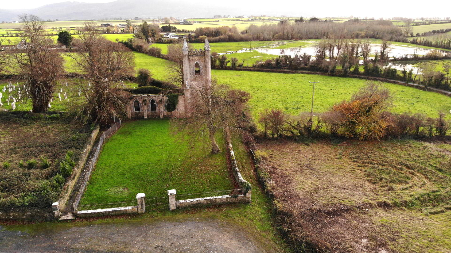
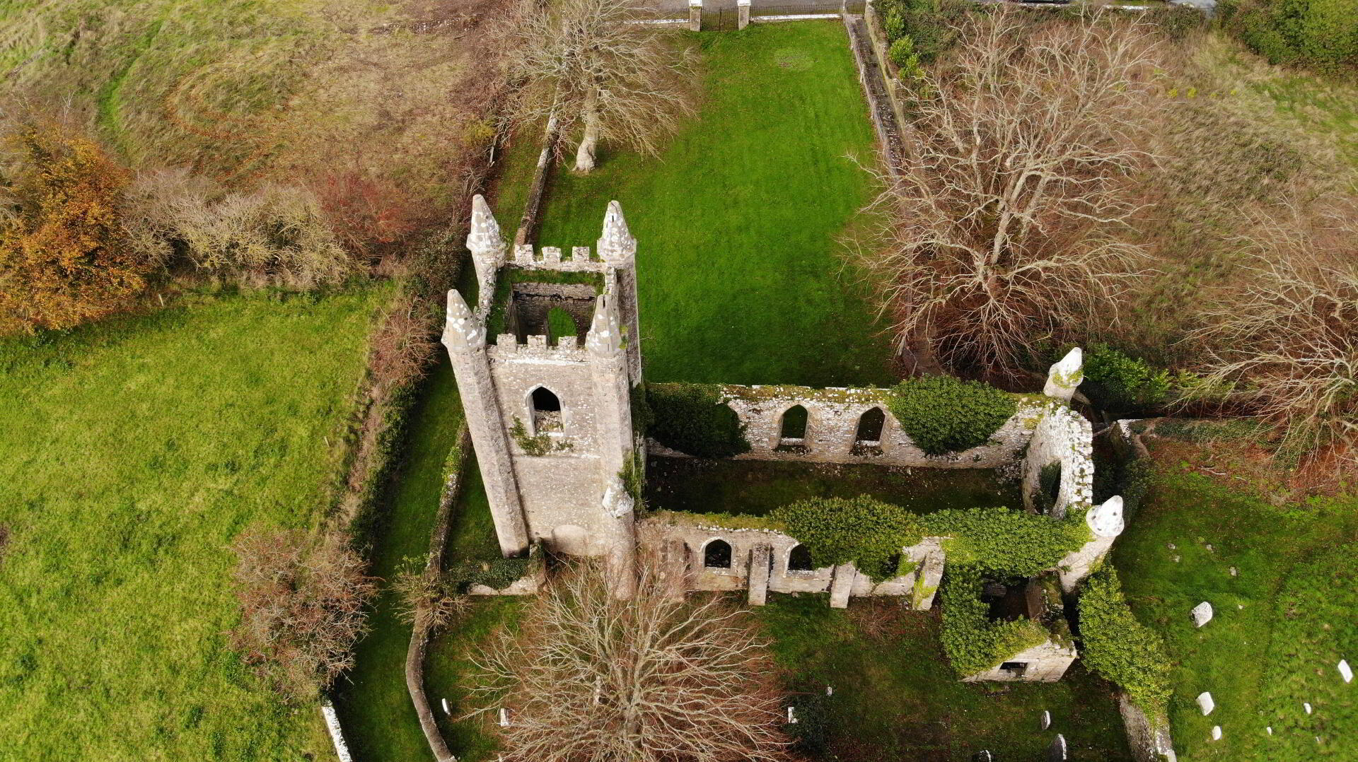
The church was designed by the distinguished architect James Pain, a former apprentice of John Nash, who was also responsible for the designs of Dromoland Castle, Mitchelstown Castle, and many churches across Munster.
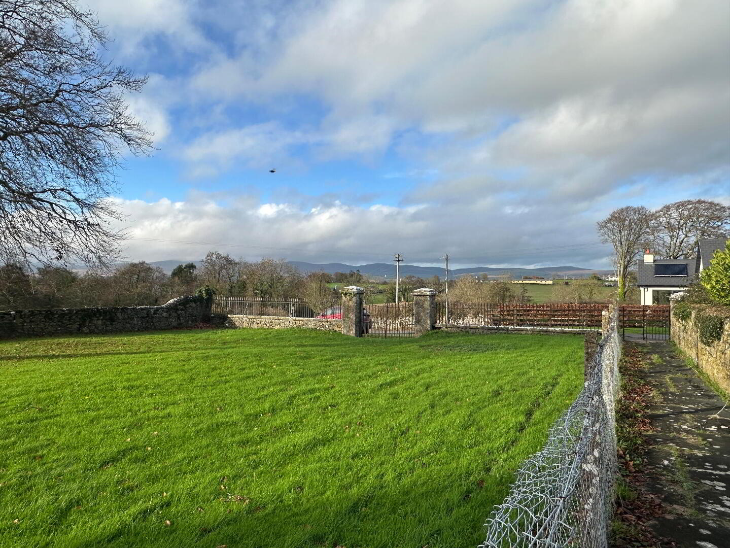
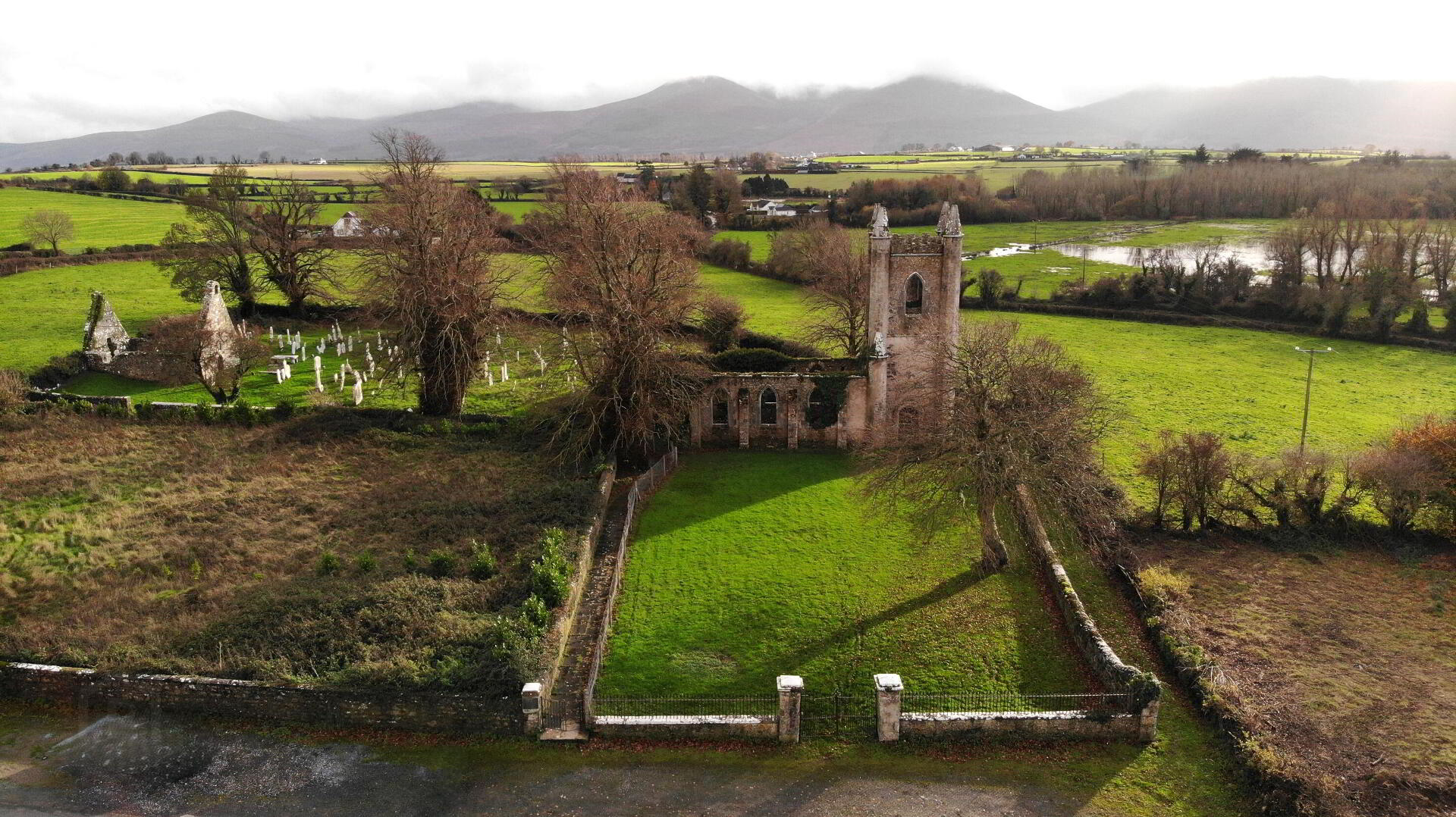
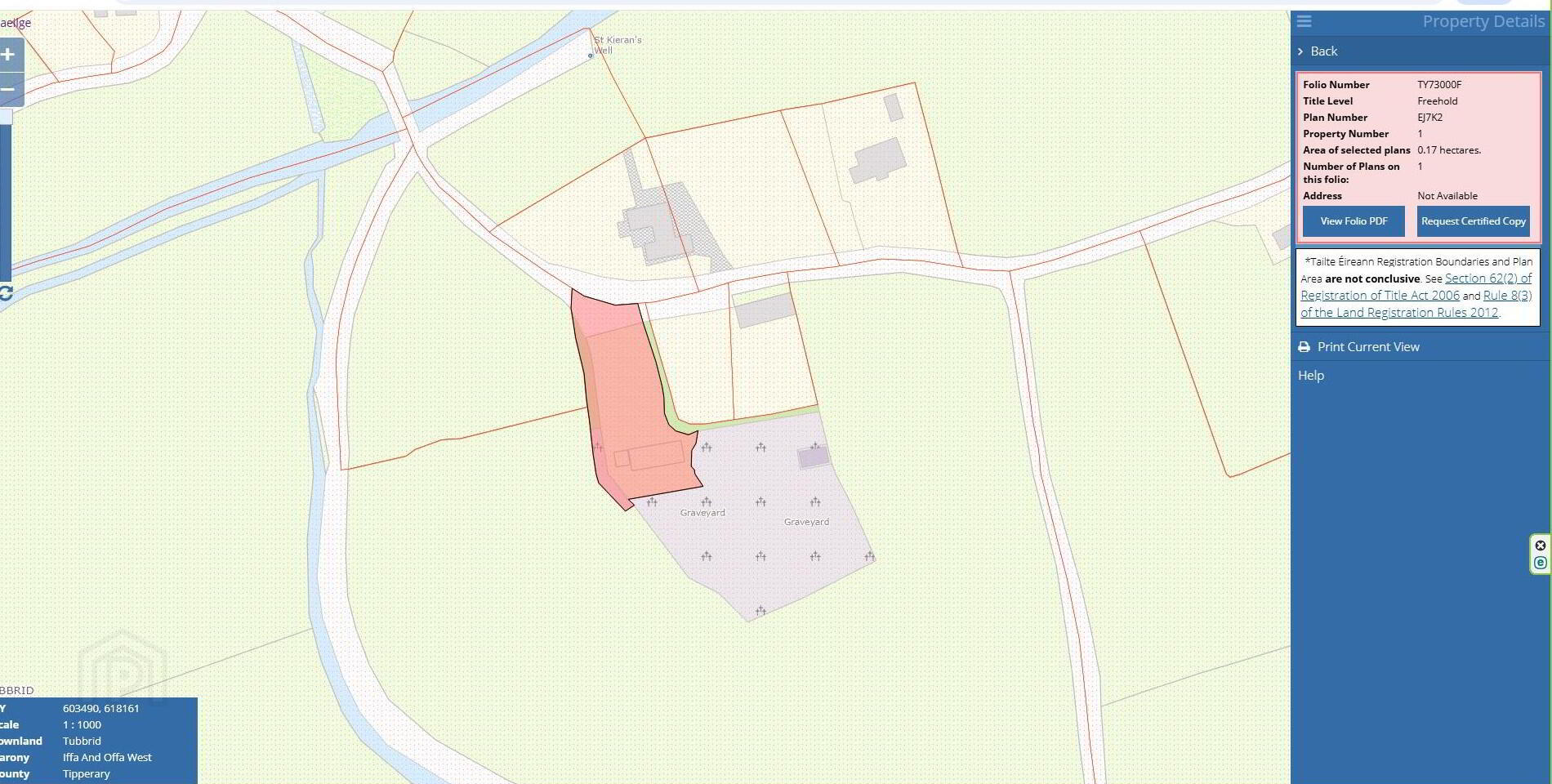
Both the church and its grounds have been exceptionally well preserved. Set in an elevated position, St Johnâ??s commands magnificent views of the Vee and the Knockmealdown Mountains. The site also features a nearby holy well, the ruins of an earlier church to the rear, a beautifully maintained lawn to the front, and its original cast-iron gates and railings, which still stand today. The church is located in a most scenic of locations circa 4km from Ardfinnan and circa 7km from Cahir , It is contained in Folio TY73000F on a site of circa 0.17 HA / 0.42 Acres
Please note the Purchasers will have to erect a boundary fence between the Church site and the Graveyard to rear
Outside
The property is located on an elevated site of circa 0.17HA / 0.42 Acres contained in Folio TY73000FDirections
The Church is located opposite Eircode E21 CC99
Travel Time From This Property

Important PlacesAdd your own important places to see how far they are from this property.
Agent Accreditations

Marketed by REA Stokes & Quirke (Clonmel)
PSR Licence: 003294
+353 52 612 1788