
Former Ballykeel Playing Fields, Crebilly Road, Ballymena, BT42 4DN
Commercial Property (12 acres)
POA
Property Overview
Status
For Sale
Style
Commercial Property
Property Features
Size
12 acres

Marketed by Ambit CRE
+44 28 9050 1501
Additional Information
- c.12 acres (4.86 ha) of potential development land
- Located within the Ballymena Development Limit and identified as White Land under the Ballymena Area Plan 1986-2001
- Potential for residential development, subject to securing necessary planning permission
- Located 0.6 miles from Ballymena town centre
- Excellent accessibility being located just 0.8 miles from the M2 motorway
- Established residential location close to a range of local amenities and community facilities
- Offers sought for the Freehold interest
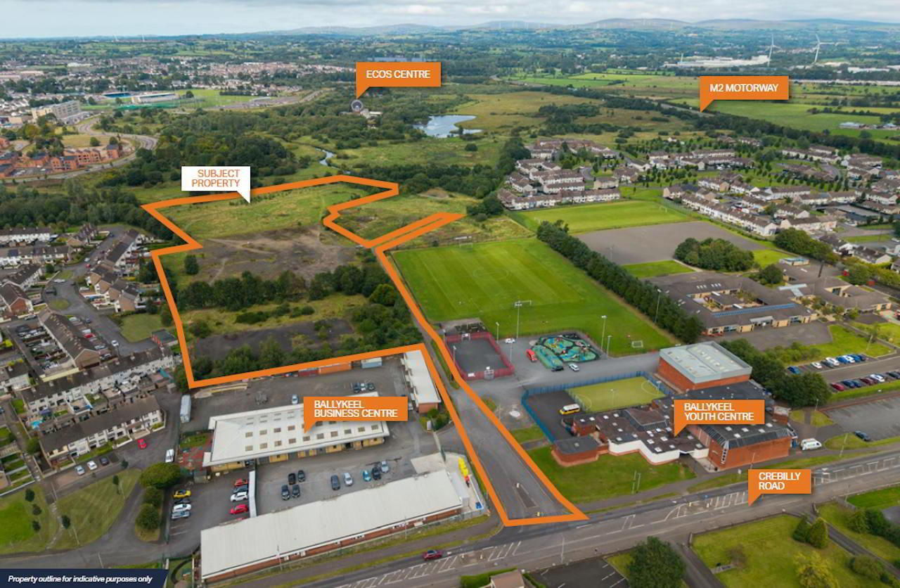
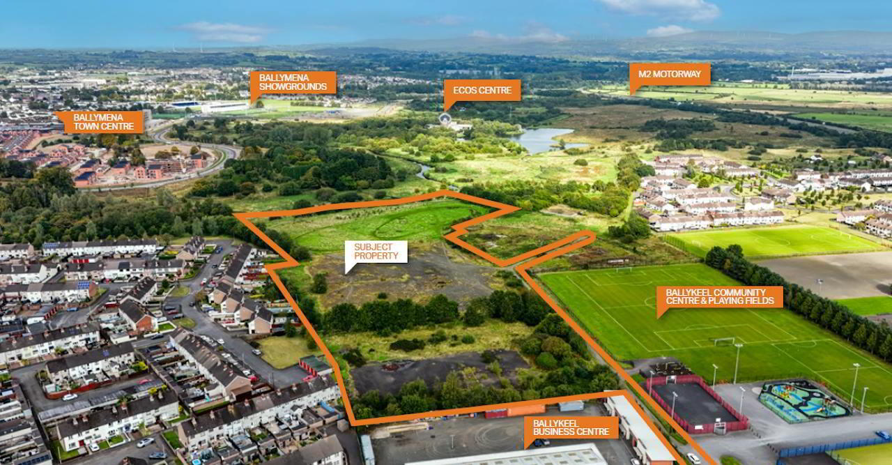
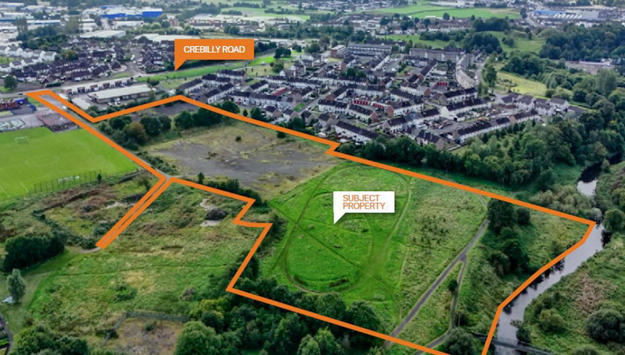
The property comprises approximately 12 acres (4.86 ha) of land situated within the Ballymena Development Limit and is considered to offer potential for residential development, subject to planning permission and all necessary statutory approvals.
Access is provided from Crebilly Road via Ballykeel Lane. The property comprises three principal areas:
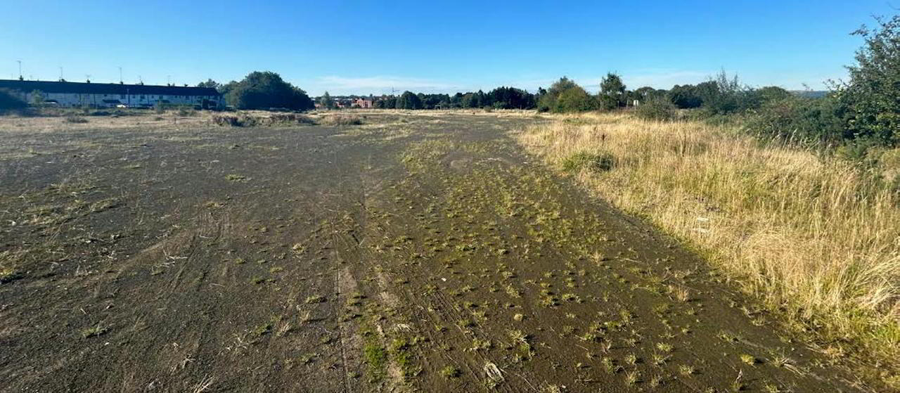
- The former Ballykeel Primary School site, where the school buildings have been demolished and the land is presently finished in a mixture of tarmac and hardcore.
- The former hockey pitches, comprising a substantial, generally level area finished predominantly in gravel.
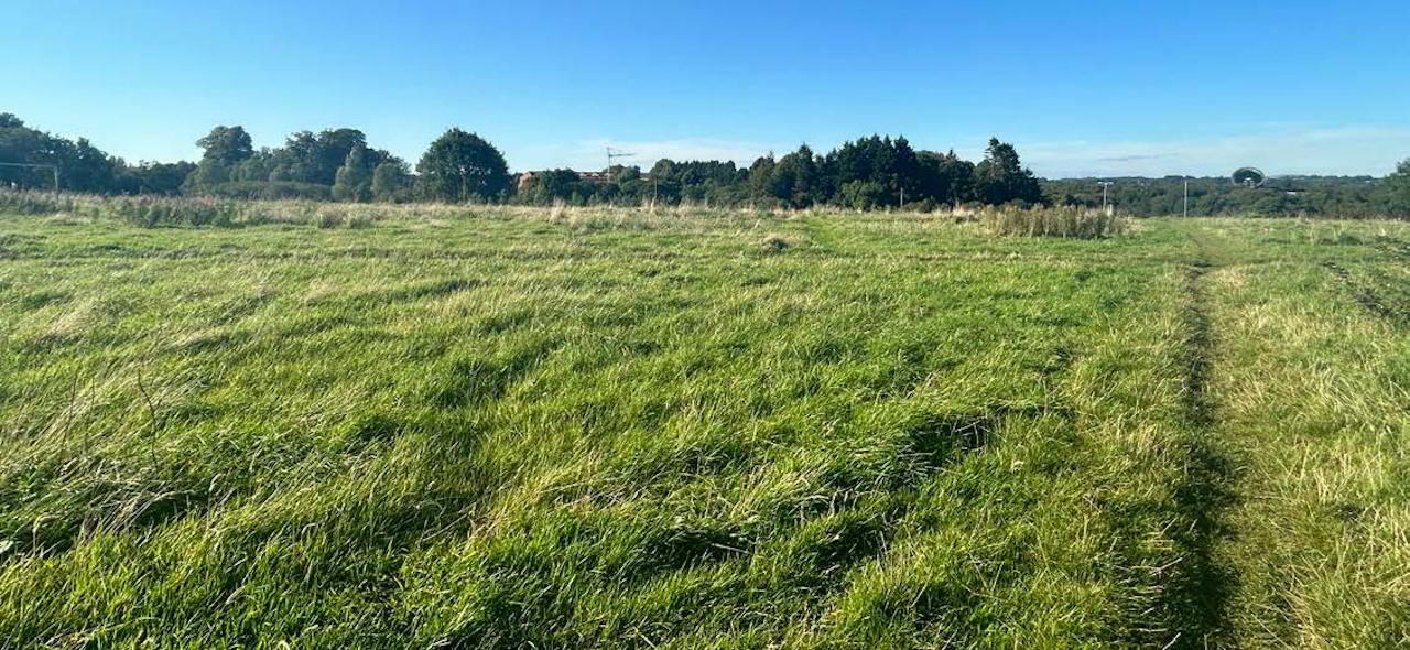
- Grassed lands extending northwards towards the River Braid.
The property is generally level, with a gradual fall towards the River Braid along its northern boundary. A surfaced public path crosses part of the northern lands, and a portion of the riverbank is understood to fall within the identified floodplain.
Known utility and drainage infrastructure crosses parts of the property, including a trunk sewer crossing the grassed area towards the River Braid and storm water drainage extending through the site and along Ballykeel Lane. Other services and drainage infrastructure are also located within or adjoining the property. Further details are available upon request.
The freehold interest in Ballykeel Lane forms part of the property. The lane is subject to various existing rights of way and service rights benefiting neighbouring owners and statutory undertakers.
The property is located on the north side of Crebilly Road, approximately 0.6 miles from Ballymena town centre. Ballymena has a population of approximately 31,000 people (2021 Census) and is one of Northern Ireland’s principal regional towns.
Crebilly Road is situated just off the A26 Larne Road Link, which provides direct access to Ballymena town centre and Junction 10 of the M2 motorway. The property therefore benefits from excellent connectivity to Belfast, Antrim, Larne and the wider regional road network.
The surrounding area comprises a mix of established residential neighbourhoods, recreational land, community facilities and commercial uses, including:
North: The River Braid, the Ecos Centre and the residential development at the former St Patrick’s Barracks.
East: Ballykeel Primary School, Ballykeel Community Centre, playing fields and play area, and the residential development at Orkney Drive.
South: Crebilly Road, Tesco Superstore, Ballykeel Youth Centre and Ballykeel Business Centre.
West: The A26 Larne Road Link and the established residential neighbourhood at Arran Avenue.
The property is located within the Ballymena Development Limit and is identified as White Land under the Ballymena Area Plan 1986–2001.
The Mid and East Antrim Local Development Plan 2030 Plan Strategy was adopted in October 2023 and, together with the relevant site-specific provisions of the existing Area Plan, forms part of the prevailing planning policy framework.
The surrounding area has experienced recent residential development, including approximately 140 dwellings delivered on the former St Patrick’s Barracks site to the north of the River Braid.
Full planning permission was granted on 29 April 2025 for a residential development on adjoining lands at 24 Crebilly Road, details of which are summarised below:
Address: Lands at 24 Crebilly Road, Ballymena, BT42 4DN
Proposal: Residential development comprising 48 dwellings, an internal road network, public open space, landscaping, parking, access and associated site works.
Reference: LA02/2024/0441/F
The adjoining landowner benefits from a right of way over Ballykeel Lane. The approved proposals include works to Ballykeel Lane in connection with the adjoining development. Further information relating to the planning permission, access arrangements and proposed works is available within the dedicated data room for the property.
Further legal and property-related information can be made available upon request.
The property is held under Folios 21329 and 7999 County Antrim, both of which have absolute title.
We are instructed to seek offers in the region of £1.25 million, exclusive. Interested parties should note that the Vendor has sole discretion to accept or reject any offer and is not bound to accept the highest, or indeed any, offer received.
We understand that the property is not elected for VAT purposes.
Stamp duty will be the liability of the purchaser
For further information:
George Jolliffe: 028 9050 1501 / 07718 493 197
[email protected]
Viewing strictly by appointment with the sole selling agent Ambit.
As a business carrying out estate agency work we are required to verify the identity of both the vendor and the purchaser as outlined in
the following: The Money Laundering, Terrorist Financing and Transfer of Funds (Information on the Payer) Regulations 2017 – https://www. legislation.gov.uk/uksi/2017/692/contents. Any information and documentation provided by you will be held for a period of five years from when you cease to have a contractual relationship with Ambit. The information will be held in accordance with General Data Protection Regulation (GDPR) on our client file and will not be passed on to any other party, unless we are required to do so by law and regulation.
Travel Time From This Property
Important PlacesAdd your own important places to see how far they are from this property.
Agent Accreditations

Marketed by Ambit CRE
+44 28 9050 1501